Mobile LiDAR Scanning
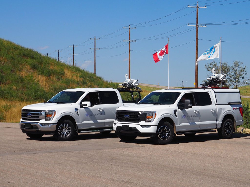
Reflektar operates high-precision mobile LiDAR scanning units capable of capturing dense 3D point clouds of any infrastructure corridor at highway speeds, with no traffic disruption and survey-grade accuracy.
What's Included
Vehicle-Mounted Mobile LiDAR
Our trucks are equipped with industry-leading Velodyne and Riegl scanners capable of capturing up to 2 million points per second across a full 360° field of view.
Millimeter-Accuracy Point Clouds
Survey-grade positioning using tightly-coupled GNSS/INS systems ensures horizontal and vertical accuracy within ±10mm even at highway speeds.
360° Spherical Imagery
Synchronized high-resolution cameras capture georeferenced panoramic imagery alongside the point cloud, enabling visual verification and photogrammetric workflows.
Rapid Corridor Coverage
Collect up to 150 km of roadway data per day without lane closures or traffic disruption — reducing fieldwork time by up to 80% versus traditional survey methods.
GPS/INS Georeferencing
All data is referenced to global coordinate systems (NAD83, WGS84) with post-processed kinematic corrections, ensuring seamless integration with existing GIS and CAD datasets.
Multi-Return Capability
Advanced multi-return processing captures first, last, and intermediate returns — enabling penetration through vegetation canopy and accurate ground model generation.
Why Choose Reflektar
No Traffic Disruption
Data is collected at posted speeds from a moving vehicle — no lane closures, no MOT, no project delays.
80% Faster than Ground Survey
Replace weeks of conventional surveying with days of mobile scanning, dramatically compressing project timelines.
Single Mobilization
One scan pass captures geometry, imagery, and asset data simultaneously — eliminating repeat site visits.
Scalable to Any Corridor
From a 500m interchange ramp to a 1,000 km provincial highway — our fleet scales to match your project scope.
Seamless Portal Integration
Raw scan data is uploaded directly to the Reflektar Portal for immediate processing, extraction, and analysis.
Full Chain of Custody
Every scan file is timestamped, georeferenced, and logged with collection metadata for audit and QA compliance.
Ready to Get Started?
Contact our team to discuss your corridor scanning requirements.